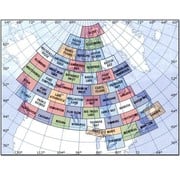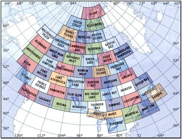
VNC Navigation Charts 1:500 000
*Please note, Toronto VNC Edition #42 is not due to be released by Nav Canada until the end of May 2024. Edition #41 is still current until that time.
The VFR Navigation Chart (VNC) is used by VFR pilots on short to extended cross-country flights at low to medium altitudes and at low to medium airspeeds. The chart displays aeronautical information and sufficient topographic detail to facilitate air navigation through the use of a unique colour scheme and layer tinting. There are 52 charts in the series. The scale is 1:500,000.
The "Next Planned Edition" is subject to change based on operational and inventory requirements. Please note that there are no expiration dates on VFR charts and each is valid until a new edition is produced.
Consult NOTAM and Canada Flight Supplement for additional data and latest information.